Monday, March 23,
2015
Departed Key Biscayne 0930
Arrived Dinner Key 1055
Mooring Field
Total day’s run 8 statute miles (7 nm), 916 miles total.
 |
| Supper in No Name Harbor |
Short trip basically straight across Biscayne
Bay. Key Biscayne was in
the news regularly during the Nixon Presidential Administration because he had
a house there referred to as the "Winter White House". Whenever I have heard about Key Biscayne, I
have thought about this so I thought I would see what I could see. The actual house that Nixon owned was single
story built of block and would certainly not fit into the neighborhood
today. It was razed in 2004, but the
helipad built out over the water to take Nixon in and out, is still there on
the southwest tip of Key Biscayne. Along
our way, we made a pass by the site and sure enough, we saw the large platform
that was the helipad…very interesting.
 |
| Helipad at the Winter White House |
 |
| Dingy dock at Dinner Key - typical |
The mooring field at Dinner Key was quite rough in the
afternoon but settled down nicely overnight.
Monday afternoon, we went into Coconut Grove which has a downtown that
has been preserved as old south Florida
coastal town. It was ok but I was not so
impressed. There was a Fresh Market
which we took advantage of.
Tuesday, March 24,
2015
Departed Dinner Key 1020
Mooring
Field
Arrived Belle Isle, Miami 1245
Total day’s run 13 statute miles (11 nm), 929 miles total.
 |
| Miami Skyline from the water |
 Comfortable night on the mooring. We took our time this morning, cleaned the
dingy bottom on a rocky beach, and made our way out of Dinner Key slowly. The skyline of Miami is something to see. I don’t think most people going to Miami get a real good
idea of the downtown…the view from the water is unobstructed and amazing. We passed under the Venetian Causeway, came
in behind Miami Beach, and anchored just to the
west of the southernmost Sunset
Island, or just north of
Grand Isle. We dingyed to a dock near
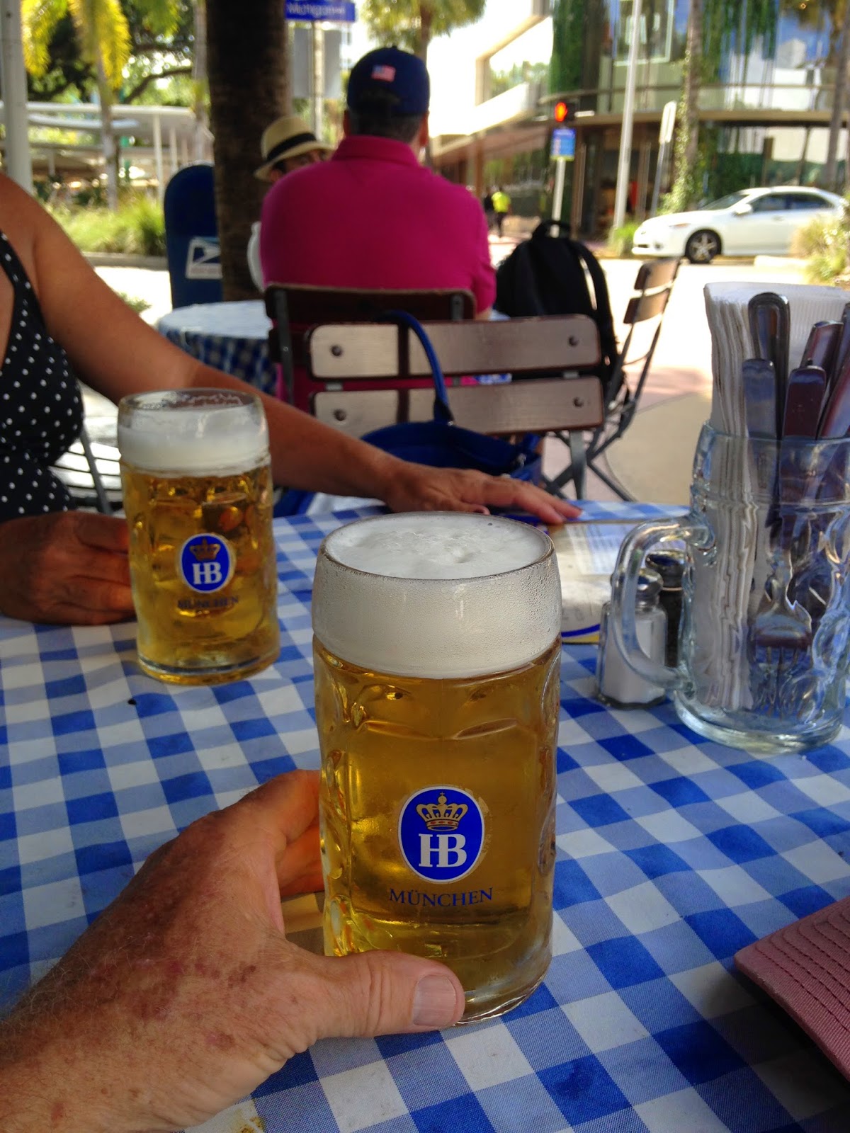
Publix and walked down Lincoln Mall (a closed off Lincoln Street) to the beachfront and
back. South Beach
is interesting and lots of hip people, but not necessarily my style. After beers at the Hofbrau restaurant, we
made our way back to Dubhe. Two people
(Larry and Denise) dinged up to us to ask about Dubhe..”What is she?”,
etc. We invited them aboard and chatted
for a while. That’s what cruising people
do. Another good supper by Nancy and I hope I can
finish this. Without Nancy, I could never make this trip. I love her but many times I do not express it
as I should. Another thing this trip is
teaching me.
Comfortable night on the mooring. We took our time this morning, cleaned the
dingy bottom on a rocky beach, and made our way out of Dinner Key slowly. The skyline of Miami is something to see. I don’t think most people going to Miami get a real good
idea of the downtown…the view from the water is unobstructed and amazing. We passed under the Venetian Causeway, came
in behind Miami Beach, and anchored just to the
west of the southernmost Sunset
Island, or just north of
Grand Isle. We dingyed to a dock near
Publix and walked down Lincoln Mall (a closed off Lincoln Street) to the beachfront and
back. South Beach
is interesting and lots of hip people, but not necessarily my style. After beers at the Hofbrau restaurant, we
made our way back to Dubhe. Two people
(Larry and Denise) dinged up to us to ask about Dubhe..”What is she?”,
etc. We invited them aboard and chatted
for a while. That’s what cruising people
do. Another good supper by Nancy and I hope I can
finish this. Without Nancy, I could never make this trip. I love her but many times I do not express it
as I should. Another thing this trip is
teaching me.  |
| Anchored behind Miami Beach |
 |
| Miami Beach |
Wednesday, March 25,
2015
Departed Belle Isle, Miami 0700
Anchorage
Arrived Fort
Lauderdale 1330
Las Olas
Marina
Total day’s run 29 statute miles (25 nm), 958 miles total.
 |
| Sunny Isle |
After a quiet night at anchor, we started out for an early start but
before we could get to the ICW, fog rolled in from the west. Fog is one of the worst case conditions on the water and I
will not run in it unless I am caught out or forced to for some other extreme reason. So we held up and hovered off of the ICW for
an hour and forty five minutes until it began to lift and visibility was
acceptable. Once the fog was gone, the
day was beautiful, sunny, and warm. We
came upon an area I had not heard of; Sunny Isle, which for a few miles had
more high rise condominiums than I have ever seen in one place. It rivaled the Miami skyline but a little more spread out. I will not go into the wealth displayed along the waterway in Fort
Lauderdale.
 |
| Can't resist selfies at the beach. |
So why do I not like having the bridges open? Most of them have restricted opening times so
often we have to wait. In three cases
this day, when we passed through a bridge, we were a mile or slightly more from
the next bridge which would open in 15 minutes.
At Dubhe’s maximum speed we could barely make it and sometimes we
can’t…then we have to wait at least ½ hour for the next opening. If you have a lot of bridges to pass, this
can add up to a lot of dithering time.
The other reason is that I have empathy with the drivers who are delayed
so I can cruise through, but that’s just me.
We are staying at the Los Olas marina in Fort Lauderdale, where we stayed when we
cruised on our sailboat 31 years ago, but of course it has changed. We’ve decided to stay two nights since it has
been almost a week since we have been in a marina. However, it looks like a strong front with high
winds is coming Friday, so we may stay an extra day. On our next leg, Nancy says we have to open 12 bridges!
 |
| Just another beach (Fort Lauderdale) |
 |
| Our neighborhood. |
 | |
| Las Olas marina. Dubhe in the lower right. |
Looks like our decision to stay in Fort Lauderdale one more night was a good one. This afternoon (Friday) there have been wind gusts to 50 mph and severe thunderstorms at the time we would be anchoring. Tomorrow will be windy but sunny so we will head out early. We hope to make West Palm Beach which is about 50 miles and 12 or more bridges away. Today Nancy got to lay on the beach as much as she wanted and I went to Sailorman; a used (and new) marine supply place we went to 31 years ago. I was able to find a complete set of zinc anodes for Dubhe at a cost half of what West Marine would be. Now I have to get them on and figure out why they are eroding so quickly...that's another story.
 | ||
| Why we stayed in Fort Lauderdale another day. |
Saturday, March 28,
2015
Departed Fort
Lauderdale 0740
Las Olas
Marina
Arrived Lake Worth 1840
Anchorage
Total day’s run 53 statute miles (46 nm), 1011 miles total.
On this leg, we passed the 1000 mile mark for our cruise!
 |
| Headed North |
This must have been our longest day of the cruise so far,
primarily due to draw bridges. We had to
open 18 on this leg!! Before
leaving Fort Lauderdale, I measured the height of the mast again, and with the
antenna at the top, we are actually 26’ above the water, 27’ with a foot of margin,
as opposed to 28’ (including a foot of margin) which I have been using.
 |
| Another Bridge, note board on lower right of bridge fender |
The inconsistency in posting the heights at the bridges is
hard to comprehend. All have a board at
the water that gives a clearance based on the water level so of course there is
more clearance when the water is low and less when the water is high. The clearance numbers are supposed to be
based on mean high water. Unfortunately,
many of the boards are covered with growth and are difficult or impossible to
read…but that’s not the big issue…the real issue is: What does the clearance
number mean? Sometimes it is the
clearance to “low steel” (lowest point along the side, particularly where the
span is an arch) and sometimes it is clearance to the center. Sometimes it tells you which and sometimes it
does not. When it is to low steel, there
will be additional clearance at the center, generally 3 to 5 feet. Sometimes this is stated on a sign but
usually not. When you ask the bridge
tender what is the additional clearance at the center, most reply that they
cannot tell us for insurance reasons.
One tender told us to “use our imagination”. It seems most of the bridges have clearance
from about 21 feet to 27 feet so a couple of extra feet will make the
difference between having to open and not.
At one bridge, the tender was reluctant to open for us but I explained
that the board read 22’ of clearance and asked what the additional clearance
was at the center. He would not tell us
so I demanded that the bridge be opened.
Another tender was just the opposite…she said that we could clear the
bridge. I told her that the board read
22 feet of clearance. Her reply was that
there was 3 to 5 feet extra at the center.
I asked her if it was 3 OR 5 and she would only say 3 to 5 and did not
seem to understand that that was not a real answer. She said she would watch so we approached
slowly and passed under with the steel antenna on the top touching the bridge. I guess it was 3 feet. The main cause of the delay was that most bridges
have restricted opening times; generally on the hour and half hour or quarter
and three quarter hour. If you get there
early, you have to wait, if you just miss it, you have to wait. They are timed so that when two are close
together (less than about 2 miles) one will be hour/half hour and the other,
quarter/three quarters, so most boats can make the distance between them and
minimize wait, but DUBHE is slow and many times we could not make it in time so
we would have to wait 20 minutes or more for the second bridge. At one place, we missed it by a minute, so we
had to wait 29 minutes. Even if you are not in a
hurry, this is frustrating.
Along the way we met a young couple on an older sailboat who
were going about our speed so we chatted while waiting for the bridges. (Tim and Callie on Vrijheid) They asked where we were going and I told them about the
anchorage at Lake Worth. From our brief conversation, I could tell
that they were new at this.
We made the excellent Lake
Worth anchorage as planned, where we anchored here 31
years ago. I am having a lot of
nostalgic moments on this cruise. I am
not an expert at many things, but anchoring is one area I consider myself to be
accomplished. This comes from wanting to
sleep well at night and fear of losing my boat.
For a rope rode (anchor line) the length, or scope, should be at least 7 times
the depth plus the distance from the water to the bow roller. In high wind and/or waves, the scope should
be increased. I’ve used more than 10 to
1 many times. For chain rode, which I use
now, the minimum scope is 3 to 1 but I like 4 or 5 to one. There is much more to anchoring, including
how the anchor is lowered, how the rode is payed out, and backing down to make
sure the anchor is set.
 |
| Vrijheid |
Some time after we anchored, Vrijheid came into Lake Worth to anchor.
I waved them over and suggested that they anchor between us and the next
boat. As a last thought, I asked if they
knew about scope, but blank faces told me that they were clueless. I watched in disbelief as Tim dropped the
anchor and 25 feet or so of chain (in 15 feet of water) with 5 feet of rope,
and walked back to the cockpit. I called
across the water for them to come raft up alongside us. When we were secure, and could chat, we found
that they had just bought this boat for $2000 five days before and this was
their second day out from Fort
Lauderdale. No
other sailboat experience but Tim had operated some small powerboats…and here
they are, headed to the Tampa
area...WOW. I gave them some anchoring
instructions and a 65’ length of 5/8” rope to anchor with. We wish them well.
Sunday, March 29,
2015
Departed
Lake Worth 1215
Arrived Peck
Lake 1630
Anchorage
Total day’s run 22 statute miles (19 nm), 1033 miles total.
 |
| Blue dot is where we anchored |
We had a good night’s rest and decided to go on to Peck Lake
even though the wind was north about 15-20 kts.
The anchorage at Peck
Lake is open to the north
but the forecast was for it to turn to the northeast and slack. I may have commented before about the lack of
courtesy and boat handling skills by many we have encountered, but on this leg,
we experienced gross incompetence, recklessness, and absence of any courtesy
unlike anything we have seen before.
There were a couple of incidences with large boats going way too fast in
crowded seaways that I am amazed that someone was not hurt. It seems that the peak of recklessness occurs
in what I call “bleach bottles”, (white and fat) in the 30 to 40 foot range,
particularly SeaRay boats. I don’t have
any pictures, because I was busy managing Dubhe in the mêlées.
Peck
Lake is a great
anchorage, quite and seemingly remote (but much development to the west just
beyond the trees), with a nice beach.
The area is part of the Hobo National Wildlife Refuge. Today is Palm Sunday and I think about my family at Saint John's.
No comments:
Post a Comment